Off the Grid, Into the Story: The People Drawing the Maps That Actually Matter
There's a mural in the Pilsen neighborhood of Chicago that isn't on any official city landmark registry. There's no plaque. No QR code. No mention in any tourism guide. But ask anyone who grew up within a six-block radius and they'll tell you exactly what it means — who painted it, when, why, and what got torn down to make room for the building it's painted on.
That mural exists in two places: on a brick wall, and in the memories of people who've never written anything about it anywhere official. A small group of Pilsen residents is working to change the second part of that equation. They're building a neighborhood map — hand-drawn, community-edited, constantly evolving — that documents places like this one. Places that matter but don't make the cut for the kind of preservation that comes with funding and institutional backing.
They're not alone.
The Places That Don't Get Plaques
Across the United States, grassroots mapmakers are doing something quietly radical: deciding for themselves what's worth remembering and where it lives. Not waiting for a city council vote or a historical society grant. Just drawing the map they wish existed.
In New Orleans' Tremé neighborhood — one of the oldest African American communities in the country — a collective called Roots Route has spent the past three years documenting what they call "social geography": the barbershop where civil rights organizing happened in the sixties, the corner where a beloved brass band used to rehearse before the building was demolished, the vacant lot that used to be a community garden before the city sold it to a developer. None of this is in any official record. All of it is in the memories of people who are getting older.
"The city will tell you what it values by what it preserves," says Darnell Okafor, one of the project's co-founders. "We're telling our own story about what we value. And we're doing it before the last person who remembers is gone."
Roots Route's map exists in two forms: a large printed version that lives in a community center and gets updated with sticky notes and pencil marks, and a digital version built on an open-source mapping platform that anyone with a phone can add to.
Paper and Pins
The tools these community cartographers are using range from the beautifully analog to the practically digital, and often both at once.
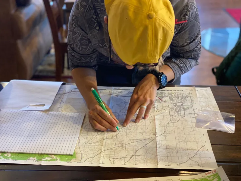
In Tucson, a woman named Rosa Grijalva has been making hand-drawn maps of her barrio for going on seven years. She started with her own block — drawing the houses, noting which families had been there for generations, marking the spots where neighborhood kids used to play before a parking structure went in. Then her neighbors started asking to be included. Then their neighbors. Now Rosa's maps cover twelve square blocks and fill four large-format sketchbooks.
"A city planner looks at a block and sees zoning codes," Rosa says. "I look at it and see forty years of quinceañeras and backyard cookouts and the lady on the corner who knew every kid's name."
What Rosa is making isn't just a historical document. It's an argument. An assertion that the meaning of a place belongs to the people who lived it, not to whoever holds the deed.
That argument has real stakes. In cities across the country, neighborhoods are being redeveloped in ways that erase exactly this kind of layered community history. When a building goes up, the story of what was there before often disappears entirely — unless somebody made a map.
Crowdsourcing the Sacred
Not all of what these mapmakers are documenting is officially historic in any traditional sense. Some of it is deeply personal. Some of it is spiritual.
In the Four Corners region of the Southwest, Indigenous-led mapping projects are documenting sites of cultural and ceremonial significance that were never included in federal land surveys — and in some cases, were deliberately omitted from them. These maps are careful about what they share publicly; some information is kept within communities specifically because broader visibility could lead to exploitation or desecration.
But the act of mapping itself is significant. It's a declaration: this place has meaning, and we are the ones who get to say so.
In Detroit, a collective called Memory Grid has taken a different approach, using a simple Google Form to collect location-tagged stories from residents about places that shaped them. The form asks three questions: Where is it? What happened there? Why does it matter? The responses get plotted on a shared map and paired with the submitted stories.
Some of the pins mark grand things — churches, community centers, famous venues. Others mark the sidewalk outside a school where a group of friends used to meet every morning for a decade. A bus stop where someone's grandmother waited every day until she couldn't anymore. A corner store that's now a chain pharmacy.
"The small stuff is the real stuff," says Memory Grid organizer Tamara Hines. "Big institutions get remembered. The small moments of community — those only survive if someone decides to save them."
The Map as a Living Thing
What sets these projects apart from traditional historical preservation is that they're explicitly designed to be unfinished. They're not trying to produce a definitive record. They're trying to keep a conversation going.
The Pilsen map in Chicago gets a new addition almost every week. Sometimes it's a building. Sometimes it's a story about a building that no longer exists. Sometimes it's a correction — someone noting that a date was wrong, or that a name was misspelled, or that there's more to the story than what's written.
That's the whole point. A living document that reflects a living community is always going to be a little incomplete, a little contested, a little messy. That's not a flaw. That's what it means to be real.
Official maps tell you how to get somewhere. These ones tell you why it matters that you go.